Main Content


North America
::
Clipperton Island
Print
Page last updated on December 17, 2020
The World Factbook
Country/Location Flag Modal
North America ::
Clipperton Island
Print
Flag Description
the flag of France is used
The World Factbook
Country/Location Locator Map Modal
North America ::
Clipperton Island
Print

The World Factbook
Country/Location Photo Gallery Modal
North America ::
Clipperton Island

1 /
1
Caption
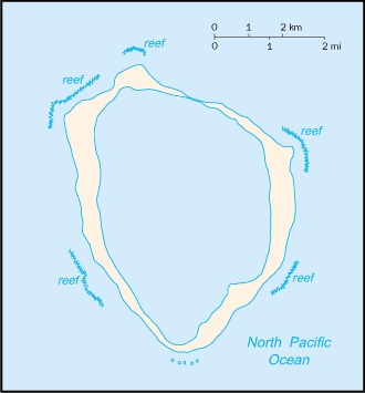
The coral reef that makes up Clipperton Island forms a complete ring. Image courtesy of NASA.
Dimensions
File Size
Download
Usage
Factbook photos - obtained from a variety of sources - are in the public domain
and are copyright free.
Agency Copyright Notice
Agency Copyright Notice
-
Introduction :: Clipperton Island
-
 This isolated atoll was named for John CLIPPERTON, an English pirate who was rumored to have made it his hideout early in the 18th century. Annexed by France in 1855 and claimed by the US, it was seized by Mexico in 1897. Arbitration eventually awarded the island to France in 1931, which took possession in 1935.
 -
Geography :: Clipperton Island
-
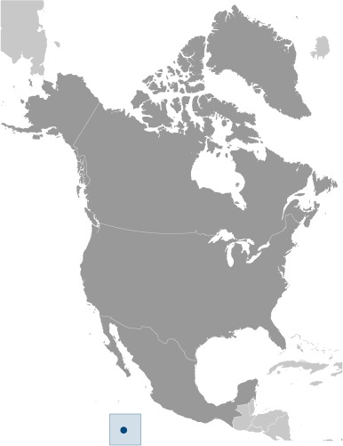
Middle America, atoll in the North Pacific Ocean, 1,120 km southwest of Mexico
10 17 N, 109 13 W
Political Map of the World
about 12 times the size of The Mall in Washington, DC
0 km
11.1 km
territorial sea: 12 nmexclusive economic zone: 200 nm
tropical; humid, average temperature 20-32 degrees Celsius, wet season (May to October)
coral atoll
lowest point: Pacific Ocean 0 mhighest point: Rocher Clipperton 29 m
fish
agricultural land: 0% (2011 est.)arable land: 0% (2011 est.) / permanent crops: 0% (2011 est.) / permanent pasture: 0% (2011 est.)forest: 0% (2011 est.)other: 100% (2011 est.)
subject to tropical storms and hurricanes from May to October
no natural resources, guano deposits depleted; the ring-shaped atoll encloses a stagnant fresh-water lagoon
the atoll reef is approximately 12 km (7.5 mi) in circumference; an attempt to colonize the atoll in the early 20th century ended in disaster and was abandoned in 1917
-
People and Society :: Clipperton Island
-
uninhabited
-
Government :: Clipperton Island
-
conventional long form: noneconventional short form: Clipperton Islandlocal long form: nonelocal short form: Ile Clippertonformer: sometimes referred to as Ile de la Passion or Atoll Clippertonetymology: named after an 18th-century English pirate who supposedly used the island as a base
possession of France; administered directly by the Minister of Overseas France
the laws of France apply
the flag of France is used
-
Economy :: Clipperton Island
-
Although 115 species of fish have been identified in the territorial waters of Clipperton Island, tuna fishing is the only economically viable species.
-
Transportation :: Clipperton Island
-
none; offshore anchorage only
-
Military and Security :: Clipperton Island
-
defense is the responsibility of France
-
Transnational Issues :: Clipperton Island
-
none