Main Content


Australia - Oceania
::
Howland Island
Print
Page last updated on December 17, 2020
The World Factbook
Country/Location Flag Modal
Australia - Oceania ::
Howland Island
Print
Flag Description
the flag of the US is used
The World Factbook
Country/Location Locator Map Modal
Australia - Oceania ::
Howland Island
Print

The World Factbook
Country/Location Photo Gallery Modal
Australia - Oceania ::
Howland Island

1 /
1
Caption
Howland Island is a US possession located in the north Pacific between Australia and the Hawaiian Islands. Prior to 1890, organic nitrate (guano) was mined from the island by both the US and the British. This tiny island (2.6 sq km) is currently part of the US National Wildlife Refuge system, and provides nesting areas and forage for a variety of birds and marine wildlife.
Dimensions
File Size
Download
Usage
Factbook photos - obtained from a variety of sources - are in the public domain
and are copyright free.
Agency Copyright Notice
Agency Copyright Notice
-
Introduction :: Howland Island
-
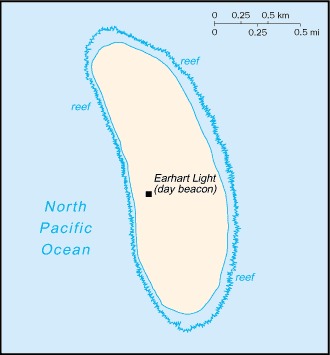
 Discovered by the US early in the 19th century, the island was officially claimed by the US in 1857. Both US and British companies mined for guano until about 1890. Earhart Light, a day beacon near the middle of the west coast, was partially destroyed during World War II, but subsequently rebuilt; it is named in memory of the famed aviatrix Amelia EARHART. The island is administered by the US Department of the Interior as a National Wildlife Refuge.
 -
Geography :: Howland Island
-
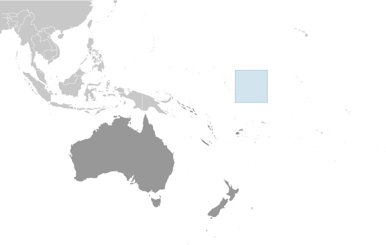
Oceania, island in the North Pacific Ocean, about half way between Hawaii and Australia
0 48 N, 176 38 W
Oceania
about three times the size of The Mall in Washington, DC
0 km
6.4 km
territorial sea: 12 nmexclusive economic zone: 200 nm
equatorial; scant rainfall, constant wind, burning sun
low-lying, nearly level, sandy, coral island surrounded by a narrow fringing reef; depressed central area
guano (deposits worked until late 1800s), terrestrial and aquatic wildlife
the narrow fringing reef surrounding the island can be a maritime hazard
no natural fresh water resources
almost totally covered with grasses, prostrate vines, and low-growing shrubs; small area of trees in the center; primarily a nesting, roosting, and foraging habitat for seabirds, shorebirds, and marine wildlife
-
People and Society :: Howland Island
-
uninhabited
note: American civilians evacuated in 1942 after Japanese air and naval attacks during World War II; occupied by US military during World War II but abandoned after the war; public entry is by special-use permit from US Fish and Wildlife Service only and generally restricted to scientists and educators; visited annually by US Fish and Wildlife Service
-
Government :: Howland Island
-
conventional long form: noneconventional short form: Howland Islandetymology: named after the lookout on a whaling vessel who spotted the island in 1842
unincorporated territory of the US; administered from Washington, DC, by the Fish and Wildlife Service of the US Department of the Interior as part of the National Wildlife Refuge System
the laws of the US apply where applicable
the flag of the US is used
-
Transportation :: Howland Island
-
none; offshore anchorage only; note - there is one small boat landing area along the middle of the west coast
Earhart Light, a day beacon near the middle of the west coast, was partially destroyed during World War II but rebuilt during the 1960s; today it is crumbling and in poor repair; named in memory of famed aviatrix Amelia EARHART
-
Military and Security :: Howland Island
-
defense is the responsibility of the US; visited annually by the US Coast Guard (2019)
-
Transnational Issues :: Howland Island
-
none