Location:
This entry identifies the country's regional location, neighboring countries, and adjacent bodies of water.

Middle East, bordering the Mediterranean Sea, between Egypt and Israel
Geographic coordinates:
This entry includes rounded latitude and longitude figures for the centroid or center point of a country expressed in degrees and minutes; it is based on the locations provided in the Geographic Names Server (GNS), maintained by the National Geospatial-Intelligence Agency on behalf of the US Board on Geographic Names.
Map references:
This entry includes the name of the Factbook reference map on which a country may be found. Note that boundary representations on these maps are not necessarily authoritative. The entry on Geographic coordinates may be helpful in finding some smaller countries.
Area:
This entry includes three subfields. Total area is the sum of all land and water areas delimited by international boundaries and/or coastlines. Land area is the aggregate of all surfaces delimited by international boundaries and/or coastlines, excluding inland water bodies (lakes, reservoirs, rivers). Water area is the sum of the surfaces of all inland water bodies, such as lakes, reservoirs, or rivers, as delimited by international boundaries and/or coastlines.
total:
360 sq km
land:
360 sq km
water:
0 sq km
country comparison to the world:
206
Area - comparative:
This entry provides an area comparison based on total area equivalents. Most entities are compared with the entire US or one of the 50 states based on area measurements (1990 revised) provided by the US Bureau of the Census. The smaller entities are compared with Washington, DC (178 sq km, 69 sq mi) or The Mall in Washington, DC (0.59 sq km, 0.23 sq mi, 146 acres).
slightly more than twice the size of Washington, DC
Land boundaries:
This entry contains the total length of all land boundaries and the individual lengths for each of the contiguous border countries. When available, official lengths published by national statistical agencies are used. Because surveying methods may differ, country border lengths reported by contiguous countries may differ.
total:
72 km
border countries (2):
Egypt 13 km, Israel 59 km
Coastline:
This entry gives the total length of the boundary between the land area (including islands) and the sea.
Maritime claims:
This entry includes the following claims, the definitions of which are excerpted from the United Nations Convention on the Law of the Sea (UNCLOS), which alone contains the full and definitive descriptions: territorial sea - the sovereignty of a coastal state extends beyond its land territory and internal waters to an adjacent belt of sea, described as the territorial sea in the UNCLOS (Part II); this sovereignty extends to the air space over the territorial sea as well as its underlying s . . .
more
see entry for Israel
note: effective 3 January 2009, the Gaza maritime area is closed to all maritime traffic and is under blockade imposed by Israeli Navy until further notice
Climate:
This entry includes a brief description of typical weather regimes throughout the year; in the Word entry only, it includes four subfields that describe climate extremes:ten driest places on earth (average annual precipitation) describes the annual average precipitation measured in both millimeters and inches for selected countries with climate extremes.
ten wettest places on earth (average annual precipitation) describes the annual average precipitation measured in both millimeters and i . . .
more
temperate, mild winters, dry and warm to hot summers
Terrain:
This entry contains a brief description of the topography.
flat to rolling, sand- and dune-covered coastal plain
Elevation:
This entry includes the mean elevation and elevation extremes, lowest point and highest point.
lowest point:
Mediterranean Sea 0 m
highest point:
Abu 'Awdah (Joz Abu 'Awdah) 105 m
Natural resources:
This entry lists a country's mineral, petroleum, hydropower, and other resources of commercial importance, such as rare earth elements (REEs). In general, products appear only if they make a significant contribution to the economy, or are likely to do so in the future.
Irrigated land:
This entry gives the number of square kilometers of land area that is artificially supplied with water.
240 sq km; note - includes the West Bank
(2012)
Population distribution:
This entry provides a summary description of the population dispersion within a country. While it may suggest population density, it does not provide density figures.
population concentrated in major cities, particularly Gaza City in the north
Natural hazards:
This entry lists potential natural disasters. For countries where volcanic activity is common, a volcanism subfield highlights historically active volcanoes.
Environment - current issues:
This entry lists the most pressing and important environmental problems. The following terms and abbreviations are used throughout the entry:
Acidification - the lowering of soil and water pH due to acid precipitation and deposition usually through precipitation; this process disrupts ecosystem nutrient flows and may kill freshwater fish and plants dependent on more neutral or alkaline conditions (see acid rain).
Acid rain - characterized as containing harmful levels of sulfur dioxi . . .
more
soil degradation; desertification; water pollution from chemicals and pesticides; salination of fresh water; improper sewage treatment; water-borne disease; depletion and contamination of underground water resources
Geography - note:
This entry includes miscellaneous geographic information of significance not included elsewhere.
strategic strip of land along Mideast-North African trade routes has experienced an incredibly turbulent history; the town of Gaza itself has been besieged countless times in its history; there are no Israeli settlements in the Gaza Strip; the Gaza Strip settlements were evacuated in 2005
Population:
This entry gives an estimate from the US Bureau of the Census based on statistics from population censuses, vital statistics registration systems, or sample surveys pertaining to the recent past and on assumptions about future trends. The total population presents one overall measure of the potential impact of the country on the world and within its region. Note: Starting with the 1993 Factbook, demographic estimates for some countries (mostly African) have explicitly taken into account t . . .
more
1,918,221
(July 2020 est.)
country comparison to the world:
152
Nationality:
This entry provides the identifying terms for citizens - noun and adjective.
Ethnic groups:
This entry provides an ordered listing of ethnic groups starting with the largest and normally includes the percent of total population.
Languages:
This entry provides a listing of languages spoken in each country and specifies any that are official national or regional languages. When data is available, the languages spoken in each country are broken down according to the percent of the total population speaking each language as a first language. For those countries without available data, languages are listed in rank order based on prevalence, starting with the most-spoken language.
Arabic, Hebrew (spoken by many Palestinians), English (widely understood)
Religions:
This entry is an ordered listing of religions by adherents starting with the largest group and sometimes includes the percent of total population. The core characteristics and beliefs of the world's major religions are described below. Baha'i - Founded by Mirza Husayn-Ali (known as Baha'u'llah) in Iran in 1852, Baha'i faith emphasizes monotheism and believes in one eternal transcendent God. Its guiding focus is to encourage the unity of all peoples on the earth so that justice and peace m . . .
more
Muslim 98.0 - 99.0% (predominantly Sunni), Christian <1.0%, other, unaffiliated, unspecified <1.0% (2012 est.)
note: dismantlement of Israeli settlements was completed in September 2005; Gaza has had no Jewish population since then
MENA religious affiliation:
 PDF
PDF
Age structure:
This entry provides the distribution of the population according to age. Information is included by sex and age group as follows: 0-14 years (children), 15-24 years (early working age), 25-54 years (prime working age), 55-64 years (mature working age), 65 years and over (elderly). The age structure of a population affects a nation's key socioeconomic issues. Countries with young populations (high percentage under age 15) need to invest more in schools, while countries with older population . . .
more
0-14 years:
42.53%
(male 418,751/female 397,013)
15-24 years:
21.67%
(male 210,240/female 205,385)
25-54 years:
29.47%
(male 275,976/female 289,277)
55-64 years:
3.66%
(male 36,409/female 33,731)
65 years and over:
2.68%
(male 27,248/female 24,191)
(2020 est.)
population pyramid:

Middle East
::
Gaza Strip
Print
This is the population pyramid for Gaza Strip. A population pyramid illustrates the age and sex structure of a country's population and may provide insights about political and social stability, as well as economic development. The population is distributed along the horizontal axis, with males shown on the left and females on the right. The male and female populations are broken down into 5-year age groups represented as horizontal bars along the vertical axis, with the youngest age groups at the bottom and the oldest at the top. The shape of the population pyramid gradually evolves over time based on fertility, mortality, and international migration trends.
For additional information, please see the entry for Population pyramid on the Definitions and Notes page under the References tab.
Dependency ratios:
Dependency ratios are a measure of the age structure of a population. They relate the number of individuals that are likely to be economically "dependent" on the support of others. Dependency ratios contrast the ratio of youths (ages 0-14) and the elderly (ages 65+) to the number of those in the working-age group (ages 15-64). Changes in the dependency ratio provide an indication of potential social support requirements resulting from changes in population age structures. As fertility leve . . .
more
total dependency ratio:
71.2
youth dependency ratio:
65.7
elderly dependency ratio:
5.5
potential support ratio:
18.2
(2020 est.)
note: data represent Gaza Strip and the West Bank
Population growth rate:
The average annual percent change in the population, resulting from a surplus (or deficit) of births over deaths and the balance of migrants entering and leaving a country. The rate may be positive or negative. The growth rate is a factor in determining how great a burden would be imposed on a country by the changing needs of its people for infrastructure (e.g., schools, hospitals, housing, roads), resources (e.g., food, water, electricity), and jobs. Rapid population growth can be seen as . . .
more
2.13%
(2020 est.)
country comparison to the world:
39
Birth rate:
This entry gives the average annual number of births during a year per 1,000 persons in the population at midyear; also known as crude birth rate. The birth rate is usually the dominant factor in determining the rate of population growth. It depends on both the level of fertility and the age structure of the population.
28.6 births/1,000 population
(2020 est.)
country comparison to the world:
37
Death rate:
This entry gives the average annual number of deaths during a year per 1,000 population at midyear; also known as crude death rate. The death rate, while only a rough indicator of the mortality situation in a country, accurately indicates the current mortality impact on population growth. This indicator is significantly affected by age distribution, and most countries will eventually show a rise in the overall death rate, in spite of continued decline in mortality at all ages, as declining . . .
more
3 deaths/1,000 population
(2020 est.)
country comparison to the world:
224
Net migration rate:
This entry includes the figure for the difference between the number of persons entering and leaving a country during the year per 1,000 persons (based on midyear population). An excess of persons entering the country is referred to as net immigration (e.g., 3.56 migrants/1,000 population); an excess of persons leaving the country as net emigration (e.g., -9.26 migrants/1,000 population). The net migration rate indicates the contribution of migration to the overall level of population chan . . .
more
-4.7 migrant(s)/1,000 population
(2020 est.)
country comparison to the world:
193
Population distribution:
This entry provides a summary description of the population dispersion within a country. While it may suggest population density, it does not provide density figures.
population concentrated in major cities, particularly Gaza City in the north
Urbanization:
This entry provides two measures of the degree of urbanization of a population. The first, urban population, describes the percentage of the total population living in urban areas, as defined by the country. The second, rate of urbanization, describes the projected average rate of change of the size of the urban population over the given period of time. It is possible for a country with a 100% urban population to still display a change in the rate of urbanization (up or down). For example . . .
more
urban population:
76.7% of total population
(2020)
rate of urbanization:
3% annual rate of change
(2015-20 est.)
note: data represent Gaza Strip and the West Bank
total population growth rate v. urban population growth rate, 2000-2030:
PDF
Sex ratio:
This entry includes the number of males for each female in five age groups - at birth, under 15 years, 15-64 years, 65 years and over, and for the total population. Sex ratio at birth has recently emerged as an indicator of certain kinds of sex discrimination in some countries. For instance, high sex ratios at birth in some Asian countries are now attributed to sex-selective abortion and infanticide due to a strong preference for sons. This will affect future marriage patterns and fertilit . . .
more
at birth:
1.06 male(s)/female
0-14 years:
1.05 male(s)/female
15-24 years:
1.02 male(s)/female
25-54 years:
0.95 male(s)/female
55-64 years:
1.08 male(s)/female
65 years and over:
1.13 male(s)/female
total population:
1.02 male(s)/female
(2020 est.)
Maternal mortality rate:
The maternal mortality rate (MMR) is the annual number of female deaths per 100,000 live births from any cause related to or aggravated by pregnancy or its management (excluding accidental or incidental causes). The MMR includes deaths during pregnancy, childbirth, or within 42 days of termination of pregnancy, irrespective of the duration and site of the pregnancy, for a specified year.
27 deaths/100,000 live births
(2017 est.)
note: data represent Gaza Strip and the West Bank
country comparison to the world:
117
Infant mortality rate:
This entry gives the number of deaths of infants under one year old in a given year per 1,000 live births in the same year. This rate is often used as an indicator of the level of health in a country.
total:
14.9 deaths/1,000 live births
male:
16 deaths/1,000 live births
female:
13.9 deaths/1,000 live births
(2020 est.)
country comparison to the world:
97
Life expectancy at birth:
This entry contains the average number of years to be lived by a group of people born in the same year, if mortality at each age remains constant in the future. Life expectancy at birth is also a measure of overall quality of life in a country and summarizes the mortality at all ages. It can also be thought of as indicating the potential return on investment in human capital and is necessary for the calculation of various actuarial measures.
total population:
74.9 years
male:
73.1 years
female:
76.7 years
(2020 est.)
country comparison to the world:
122
Total fertility rate:
This entry gives a figure for the average number of children that would be born per woman if all women lived to the end of their childbearing years and bore children according to a given fertility rate at each age. The total fertility rate (TFR) is a more direct measure of the level of fertility than the crude birth rate, since it refers to births per woman. This indicator shows the potential for population change in the country. A rate of two children per woman is considered the replaceme . . .
more
3.64 children born/woman
(2020 est.)
country comparison to the world:
38
Contraceptive prevalence rate:
This field gives the percent of women of reproductive age (15-49) who are married or in union and are using, or whose sexual partner is using, a method of contraception according to the date of the most recent available data. The contraceptive prevalence rate is an indicator of health services, development, and women’s empowerment. It is also useful in understanding, past, present, and future fertility trends, especially in developing countries.
57.2%
(2014)
note: includes Gaza Strip and West Bank
Drinking water source:
This entry provides information about access to improved or unimproved drinking water sources available to segments of the population of a country. Improved drinking water - use of any of the following sources: piped water into dwelling, yard, or plot; public tap or standpipe; tubewell or borehole; protected dug well; protected spring; or rainwater collection. Unimproved drinking water - use of any of the following sources: unprotected dug well; unprotected spring; cart with small tank or . . .
more
improved:
urban:
97.1% of population
rural:
97.1% of population
total:
96.8% of population
unimproved:
urban:
2.9% of population
rural:
2.9% of population
total:
3.2% of population
(2017 est.)
note: includes Gaza Strip and the West Bank
Physicians density:
This entry gives the number of medical doctors (physicians), including generalist and specialist medical practitioners, per 1,000 of the population. Medical doctors are defined as doctors that study, diagnose, treat, and prevent illness, disease, injury, and other physical and mental impairments in humans through the application of modern medicine. They also plan, supervise, and evaluate care and treatment plans by other health care providers. The World Health Organization estimates that f . . .
more
2.77 physicians/1,000 population
(2018)
Hospital bed density:
This entry provides the number of hospital beds per 1,000 people; it serves as a general measure of inpatient service availability. Hospital beds include inpatient beds available in public, private, general, and specialized hospitals and rehabilitation centers. In most cases, beds for both acute and chronic care are included. Because the level of inpatient services required for individual countries depends on several factors - such as demographic issues and the burden of disease - there is . . .
more
1.3 beds/1,000 population
(2018)
Sanitation facility access:
This entry provides information about access to improved or unimproved sanitation facilities available to segments of the population of a country. Improved sanitation - use of any of the following facilities: flush or pour-flush to a piped sewer system, septic tank or pit latrine; ventilated improved pit (VIP) latrine; pit latrine with slab; or a composting toilet. Unimproved sanitation - use of any of the following facilities: flush or pour-flush not piped to a sewer system, septic tank . . .
more
improved:
urban:
100% of population
rural:
99.3% of population
total:
99.8% of population
unimproved:
urban:
0% of population
rural:
0.7% of population
total:
0.2% of population
(2017 est.)
note: note includes Gaza Strip and the West Bank
HIV/AIDS - adult prevalence rate:
This entry gives an estimate of the percentage of adults (aged 15-49) living with HIV/AIDS. The adult prevalence rate is calculated by dividing the estimated number of adults living with HIV/AIDS at yearend by the total adult population at yearend.
HIV/AIDS - people living with HIV/AIDS:
This entry gives an estimate of all people (adults and children) alive at yearend with HIV infection, whether or not they have developed symptoms of AIDS.
HIV/AIDS - deaths:
This entry gives an estimate of the number of adults and children who died of AIDS during a given calendar year.
Children under the age of 5 years underweight:
This entry gives the percent of children under five considered to be underweight. Underweight means weight-for-age is approximately 2 kg below for standard at age one, 3 kg below standard for ages two and three, and 4 kg below standard for ages four and five. This statistic is an indicator of the nutritional status of a community. Children who suffer from growth retardation as a result of poor diets and/or recurrent infections tend to have a greater risk of suffering illness and death.
1.4%
(2014)
note: estimate is for Gaza Strip and the West Bank
country comparison to the world:
122
5.3% of GDP
(2017)
note: includes Gaza Strip and the West Bank
country comparison to the world:
45
Literacy:
This entry includes a definition of literacy and UNESCO's percentage estimates for populations aged 15 years and over, including total population, males, and females. There are no universal definitions and standards of literacy. Unless otherwise specified, all rates are based on the most common definition - the ability to read and write at a specified age. Detailing the standards that individual countries use to assess the ability to read and write is beyond the scope of the Factbook. Info . . .
more
definition:
age 15 and over can read and write
total population:
97.2%
male:
98.7%
female:
95.7%
(2018)
note: estimates are for Gaza and the West Bank
School life expectancy (primary to tertiary education):
School life expectancy (SLE) is the total number of years of schooling (primary to tertiary) that a child can expect to receive, assuming that the probability of his or her being enrolled in school at any particular future age is equal to the current enrollment ratio at that age.
Caution must be maintained when utilizing this indicator in international comparisons. For example, a year or grade completed in one country is not necessarily the same in terms of educational content or qualit . . .
more
total:
13 years
male:
13 years
female:
14 years
(2013)
note: data represent Gaza Strip and the West Bank
total:
42.2%
male:
37%
female:
69.4%
(2018 est.)
note: includes the West Bank
country comparison to the world:
8
Economic overview:
This section briefly describes four key economic components for a given country:* National Economy, including economic histories, domestic labor and wage markets, and the economic sector portfolios that drive fiscal and monetary policymaking;* Financial Power & Public Finance, including brief discussions of lending/exchange rates, capital stocks/flows, and foreign direct investments arising from a country's financial and capital markets;* International Trade, including chief imports an . . .
more
Movement and access restrictions, violent attacks, and the slow pace of post-conflict reconstruction continue to degrade economic conditions in the Gaza Strip, the smaller of the two areas comprising the Palestinian territories. Israeli controls became more restrictive after HAMAS seized control of the territory in June 2007. Under Hamas control, Gaza has suffered from rising unemployment, elevated poverty rates, and a sharp contraction of the private sector, which had relied primarily on export markets.
Since April 2017, the Palestinian Authority has reduced payments for electricity supplied to Gaza and cut salaries for its employees there, exacerbating poor economic conditions. Since 2014, Egypt’s crackdown on the Gaza Strip’s extensive tunnel-based smuggling network has exacerbated fuel, construction material, and consumer goods shortages in the territory. Donor support for reconstruction following the 51-day conflict in 2014 between Israel and HAMAS and other Gaza-based militant groups has fallen short of post-conflict needs.
GDP real growth rate:
This entry gives GDP growth on an annual basis adjusted for inflation and expressed as a percent. The growth rates are year-over-year, and not compounded.
-15.2%
(2014 est.)
5.6%
(2013 est.)
7%
(2012 est.)
note: excludes the West Bank
country comparison to the world:
222
0.2%
(2017 est.)
-0.2%
(2016 est.)
note: excludes the West Bank
country comparison to the world:
27
GDP (purchasing power parity) - real:
This entry gives the gross domestic product (GDP) or value of all final goods and services produced within a nation in a given year. A nation's GDP at purchasing power parity (PPP) exchange rates is the sum value of all goods and services produced in the country valued at prices prevailing in the United States in the year noted. This is the measure most economists prefer when looking at per-capita welfare and when comparing living conditions or use of resources across countries. The measur . . .
more
see entry for the West Bank
GDP (official exchange rate):
This entry gives the gross domestic product (GDP) or value of all final goods and services produced within a nation in a given year. A nation's GDP at official exchange rates (OER) is the home-currency-denominated annual GDP figure divided by the bilateral average US exchange rate with that country in that year. The measure is simple to compute and gives a precise measure of the value of output. Many economists prefer this measure when gauging the economic power an economy maintains vis- . . .
more
$2.938 billion
(2014 est.)
note: excludes the West Bank
GDP - per capita (PPP):
This entry shows GDP on a purchasing power parity basis divided by population as of 1 July for the same year.
see entry for the the West Bank
GDP - composition, by sector of origin:
This entry shows where production takes place in an economy. The distribution gives the percentage contribution of agriculture, industry, and services to total GDP, and will total 100 percent of GDP if the data are complete. Agriculture includes farming, fishing, and forestry. Industry includes mining, manufacturing, energy production, and construction. Services cover government activities, communications, transportation, finance, and all other private economic activities that do not prod . . .
more
agriculture:
3%
(2017 est.)
industry:
21.1%
(2017 est.)
services:
75%
(2017 est.)
note: data exclude the West Bank
GDP - composition, by end use:
This entry shows who does the spending in an economy: consumers, businesses, government, and foreigners. The distribution gives the percentage contribution to total GDP of household consumption, government consumption, investment in fixed capital, investment in inventories, exports of goods and services, and imports of goods and services, and will total 100 percent of GDP if the data are complete. household consumption consists of expenditures by resident households, and by nonprofit insti . . .
more
household consumption:
88.6%
(2017 est.)
government consumption:
26.3%
(2017 est.)
investment in fixed capital:
22.4%
(2017 est.)
investment in inventories:
0%
(2017 est.)
exports of goods and services:
18.6%
(2017 est.)
imports of goods and services:
-55.6%
(2017 est.)
note: data exclude the West Bank
Ease of Doing Business Index scores:
The World Bank Group Doing Business project measures business regulations and enforcement mechanisms across economies and selected cities. The project evaluates domestic small and medium-size companies and measures the regulations applying to them through their life cycle. The project encourages economies to compete towards more efficient regulation; offers measurable benchmarks for reform; and serves as a resource for academics, journalists, private sector researchers and others intereste . . .
more
Agriculture - products:
This entry is an ordered listing of major crops and products starting with the most important.
olives, fruit, vegetables, flowers; beef, dairy products
Industries:
This entry provides a rank ordering of industries starting with the largest by value of annual output.
textiles, food processing, furniture
2.2%
(2017 est.)
note: see entry for the West Bank
country comparison to the world:
125
Labor force:
This entry contains the total labor force figure.
1.24 million
(2017 est.)
note: excludes the West Bank
country comparison to the world:
133
Labor force - by occupation:
This entry lists the percentage distribution of the labor force by sector of occupation. Agriculture includes farming, fishing, and forestry. Industry includes mining, manufacturing, energy production, and construction. Services cover government activities, communications, transportation, finance, and all other economic activities that do not produce material goods. The distribution will total less than 100 percent if the data are incomplete and may range from 99-101 percent due to rounding.
more
agriculture:
5.2%
industry:
10%
services:
84.8%
(2015 est.)
note: data exclude the West Bank
Unemployment rate:
This entry contains the percent of the labor force that is without jobs. Substantial underemployment might be noted.
27.9%
(2017 est.)
27%
(2016 est.)
note: data exclude the West Bank
country comparison to the world:
200
Population below poverty line:
National estimates of the percentage of the population falling below the poverty line are based on surveys of sub-groups, with the results weighted by the number of people in each group. Definitions of poverty vary considerably among nations. For example, rich nations generally employ more generous standards of poverty than poor nations.
30%
(2011 est.)
note: data exclude the West Bank
Budget:
This entry includes revenues, expenditures, and capital expenditures. These figures are calculated on an exchange rate basis, i.e., not in purchasing power parity (PPP) terms.
see entry for the West Bank
Fiscal year:
This entry identifies the beginning and ending months for a country's accounting period of 12 months, which often is the calendar year but which may begin in any month. All yearly references are for the calendar year (CY) unless indicated as a noncalendar fiscal year (FY).
Current account balance:
This entry records a country's net trade in goods and services, plus net earnings from rents, interest, profits, and dividends, and net transfer payments (such as pension funds and worker remittances) to and from the rest of the world during the period specified. These figures are calculated on an exchange rate basis, i.e., not in purchasing power parity (PPP) terms.
-$1.444 billion
(2017 est.)
-$1.348 billion
(2016 est.)
note: excludes the West Bank
country comparison to the world:
157
Exports:
This entry provides the total US dollar amount of merchandise exports on an f.o.b. (free on board) basis. These figures are calculated on an exchange rate basis, i.e., not in purchasing power parity (PPP) terms.
$1.955 billion
(2017 est.)
$1.827 billion
(2016 est.)
country comparison to the world:
145
Exports - commodities:
This entry provides a listing of the highest-valued exported products; it sometimes includes the percent of total dollar value.
strawberries, carnations, vegetables, fish (small and irregular shipments, as permitted to transit the Israeli-controlled Kerem Shalom crossing)
Imports:
This entry provides the total US dollar amount of merchandise imports on a c.i.f. (cost, insurance, and freight) or f.o.b. (free on board) basis. These figures are calculated on an exchange rate basis, i.e., not in purchasing power parity (PPP) terms.
$8.59 billion
(2018 est.)
$7.852 billion
(2017 est.)
see entry for the West Bank
country comparison to the world:
115
Imports - commodities:
This entry provides a listing of the highest-valued imported products; it sometimes includes the percent of total dollar value.
food, consumer goods, fuel
Reserves of foreign exchange and gold:
This entry gives the dollar value for the stock of all financial assets that are available to the central monetary authority for use in meeting a country's balance of payments needs as of the end-date of the period specified. This category includes not only foreign currency and gold, but also a country's holdings of Special Drawing Rights in the International Monetary Fund, and its reserve position in the Fund.
$446.3 million
(31 December 2017 est.)
$583 million
(31 December 2015 est.)
country comparison to the world:
156
Debt - external:
This entry gives the total public and private debt owed to nonresidents repayable in internationally accepted currencies, goods, or services. These figures are calculated on an exchange rate basis, i.e., not in purchasing power parity (PPP) terms.
see entry for the West Bank
Exchange rates:
This entry provides the average annual price of a country's monetary unit for the time period specified, expressed in units of local currency per US dollar, as determined by international market forces or by official fiat. The International Organization for Standardization (ISO) 4217 alphabetic currency code for the national medium of exchange is presented in parenthesis. Closing daily exchange rates are not presented in The World Factbook, but are used to convert stock values - e.g., the . . .
more
see entry for the West Bank
Telephones - fixed lines:
This entry gives the total number of fixed telephone lines in use, as well as the number of subscriptions per 100 inhabitants.
total subscriptions:
472,293
(includes the West Bank); (July 2016 est.)
subscriptions per 100 inhabitants:
9
(includes the West Bank); (July 2016 est.)
country comparison to the world:
92
Telephones - mobile cellular:
This entry gives the total number of mobile cellular telephone subscribers, as well as the number of subscriptions per 100 inhabitants. Note that because of the ubiquity of mobile phone use in developed countries, the number of subscriptions per 100 inhabitants can exceed 100.
total subscriptions:
4,135,363
(includes the West Bank)
subscriptions per 100 inhabitants:
76
(includes the West Bank) (2017 est.)
country comparison to the world:
128
Telecommunication systems:
This entry includes a brief general assessment of a country's telecommunications system with details on the domestic and international components. The following terms and abbreviations are used throughout the entry:
2G - is short for second-generation cellular network. After 2G was launched, the previous mobile wireless network systems were retroactively dubbed 1G. While radio signals on 1G networks are analog, radio signals on 2G networks are digital. Both systems use digital signaling . . .
more
general assessment:
Israel has final say in allocating frequencies in the Gaza Strip and does not permit anything beyond a 2G network
(2018)
domestic:
Israeli company BEZEK and the Palestinian company PALTEL are responsible for fixed-line services; the Palestinian JAWWAL company provides cellular services; a slow 2G network allows calls and limited data transmission; fixed-line 9 per 100 and mobile-cellular 76 per 100 (includes West Bank)
international:
country code 970 or 972
(2018)
note: the COVID-19 outbreak is negatively impacting telecommunications production and supply chains globally; consumer spending on telecom devices and services has also slowed due to the pandemic's effect on economies worldwide; overall progress towards improvements in all facets of the telecom industry - mobile, fixed-line, broadband, submarine cable and satellite - has moderated
Internet country code:
This entry includes the two-letter codes maintained by the International Organization for Standardization (ISO) in the ISO 3166 Alpha-2 list and used by the Internet Assigned Numbers Authority (IANA) to establish country-coded top-level domains (ccTLDs).
.psnote - same as the West Bank
Internet users:
This entry gives the total number of individuals within a country who can access the Internet at home, via any device type (computer or mobile) and connection. The percent of population with Internet access (i.e., the penetration rate) helps gauge how widespread Internet use is within a country. Statistics vary from country to country and may include users who access the Internet at least several times a week to those who access it only once within a period of several months.
total:
2.673 million
(includes the West Bank)
percent of population:
57.4%
(July 2016 est.)
country comparison to the world:
105
Broadband - fixed subscriptions:
This entry gives the total number of fixed-broadband subscriptions, as well as the number of subscriptions per 100 inhabitants. Fixed broadband is a physical wired connection to the Internet (e.g., coaxial cable, optical fiber) at speeds equal to or greater than 256 kilobits/second (256 kbit/s).
total:
320,500
subscriptions per 100 inhabitants:
14
(2016 est.)
country comparison to the world:
100


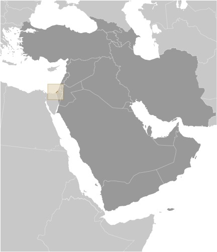


 Image DescriptionThis is the population pyramid for Gaza Strip. A population pyramid illustrates the age and sex structure of a country's population and may provide insights about political and social stability, as well as economic development. The population is distributed along the horizontal axis, with males shown on the left and females on the right. The male and female populations are broken down into 5-year age groups represented as horizontal bars along the vertical axis, with the youngest age groups at the bottom and the oldest at the top. The shape of the population pyramid gradually evolves over time based on fertility, mortality, and international migration trends.