Main Content


Antarctica
::
Bouvet Island
Print
Page last updated on December 14, 2020
The World Factbook
Country/Location Flag Modal
Antarctica ::
Bouvet Island
Print
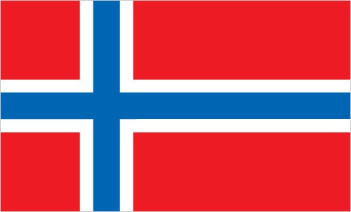
Flag Description
the flag of Norway is used
The World Factbook
Country/Location Locator Map Modal
Antarctica ::
Bouvet Island
Print

The World Factbook
Country/Location Photo Gallery Modal
Antarctica ::
Bouvet Island


1 /
2
Caption
Bouvet Island is one of the most remote islands in the world; Antarctica, over 1,600 km (1,000 mi) to the south, is the nearest land mass. Located near the junction of three tectonic plates, the island is mostly formed from a shield volcano that is almost entirely covered by glaciers. The prominent Kapp (Cape) Valdivia on the northern coastline is a peninsula formed by a lava dome. It is only along the steep cliffs of the coastline that the underlying dark volcanic rock is visible against the white snow and ice blanketing the island. Photo courtesy of NASA.
Dimensions
File Size
Download
Usage
Factbook photos - obtained from a variety of sources - are in the public domain
and are copyright free.
Agency Copyright Notice
Agency Copyright Notice

2 /
2
Caption
Aerial photo of glacier-blanketed Bouvet Island. Image courtesy of NASA.
Dimensions
File Size
Download
Usage
Factbook photos - obtained from a variety of sources - are in the public domain
and are copyright free.
Agency Copyright Notice
Agency Copyright Notice
-
Introduction :: Bouvet Island
-
 This uninhabited, volcanic, Antarctic island is almost entirely covered by glaciers making it difficult to approach; it is recognized as the most remote island on Earth. (It is furthest in distance from any other point of land, 1,639 km from Antarctica.) Bouvet Island was discovered in 1739 by a French naval officer after whom it is named. No claim was made until 1825, when the British flag was raised. A few expeditions visited the island in the late 19th century. In 1929, the UK waived its claim in favor of Norway, which had occupied the island two years previously. In 1971, Norway designated Bouvet Island and the adjacent territorial waters a nature reserve. Since 1977, Norway has run an automated meteorological station and studied foraging strategies and distribution of fur seals and penguins on the island. In February 2006, an earthquake weakened the station's foundation causing it to be blown out to sea in a winter storm. Norway erected a new research station in 2014 that can hold six people for periods of two to four months.
 -
Geography :: Bouvet Island
-
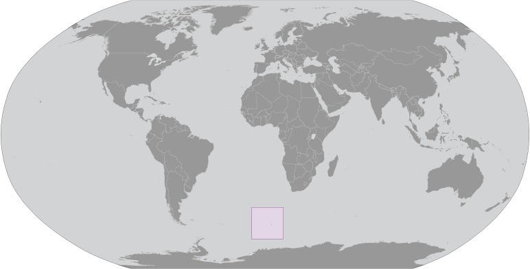
island in the South Atlantic Ocean, southwest of the Cape of Good Hope (South Africa)
54 26 S, 3 24 E
Antarctic Region
about 0.3 times the size of Washington, DC
0 km
29.6 km
territorial sea: 4 nm
antarctic
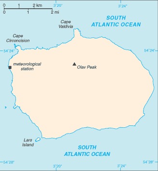
volcanic; coast is mostly inaccessible
lowest point: South Atlantic Ocean 0 mhighest point: Olavtoppen (Olav Peak) 780 m
none
agricultural land: 0% (2011 est.)arable land: 0% (2011 est.) / permanent crops: 0% (2011 est.) / permanent pasture: 0% (2011 est.)forest: 0% (2011 est.)other: 100% (2011 est.)
occasional volcanism, rock slides; harsh climate, surrounded by pack ice in winter
none; almost entirely ice covered
almost entirely covered by glacial ice (93%); declared a nature reserve by Norway; the distance from Bouvet Island to Norway is 12,776 km, which is almost one-third the circumference of the earth
-
People and Society :: Bouvet Island
-
uninhabited
-
Government :: Bouvet Island
-
conventional long form: noneconventional short form: Bouvet Islandetymology: named after the French naval officer Jean-Baptiste Charles BOUVET who discovered the island in 1739
note: pronounced boo-vay i-land
territory of Norway; administered by the Polar Department of the Ministry of Justice and Oslo Police
the laws of Norway apply where applicable
the flag of Norway is used -
Economy :: Bouvet Island
-
no economic activity; declared a nature reserve
-
Communications :: Bouvet Island
-
.bv
has an automated meteorological station
-
Transportation :: Bouvet Island
-
none; offshore anchorage only
-
Military and Security :: Bouvet Island
-
defense is the responsibility of Norway
-
Transnational Issues :: Bouvet Island
-
none